
ENVIRONMENT AND ENERGY
TUM Researchers Use SuperMUC-NG to Join Remote Sensing and Social Media Data to Observe Cities’ Growth and Change
Principal Investigator:
Prof. Xiaoxiang Zhu
Affiliation:
Remote Sensing Technology Institute, German Aerospace Center, Data Science in Earth Observation, Technical University of Munich
Local Project ID:
pr53ya, pr45ne
HPC Platform used:
SuperMUC-NG at LRZ
Date published:
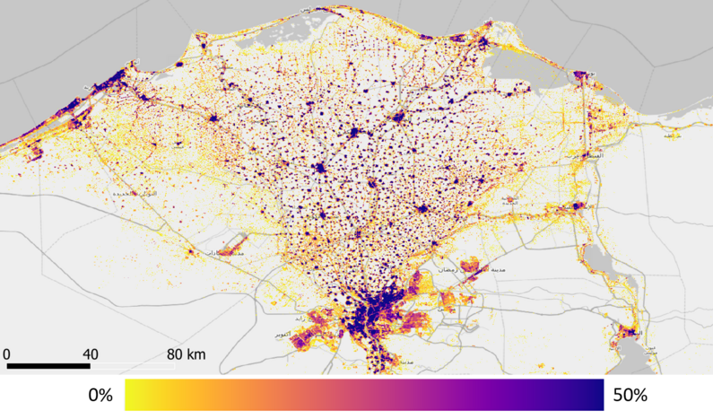
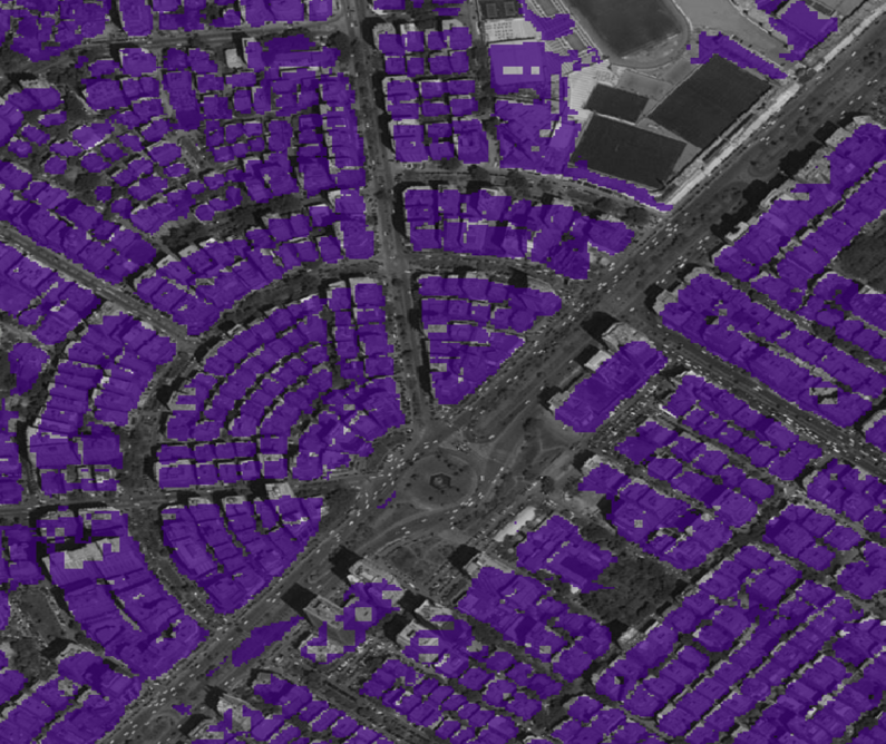
Figure 1. Upper: buildup density around Cairo, Egypt, and lower: individual building footprint in the center of Cairo
A team of researchers led by Prof. Xiaoxiang Zhu at the Technical University of Munich are using high-performance computing resources at the Leibniz Supercomputing Centre to create the first-ever 3D/4D dataset on urban morphology of settlements, joining traditional remote sensing data with social media content.
To the end, the team uses deep learning workflows in concert with traditional signal processing methods and developed their own algorithm to accurately model urban morphology. With the help of LRZ resources, the team has created detailed map of the so-called Local Climate Zones for over 1,600 cities – all cities across the globe with populations of over 300,000 people according to UN. Further, the team derived the first global building footprint map. In the years to come, the team hopes to revolutionize the information basis towards a better understanding of the global urbanization and to provide global information on buildings in 3D, settlement types and population density.
To read the full report, click here.
To read the journal article, click here.